Outdoors & Coast

Walking the Golden Road Across the Preseli Hills

Celebrating the ancient route across the Preseli Hills.

Follow the ancient Golden Road across the Preseli Hills and explore thousands of years of archaeology and legend

Explore the ancient wonders of the Preseli Hills this April through a unique guided archaeological walk and heritage gin-tasting event at Tafarn Sinc, held in support of the Pembrokeshire Coast Charitable Trust.

or thousands of years, pilgrims, farmers and the people of North Pembrokeshire have traipsed across the stunning Preseli Hills en route to their chosen destination, but few people today realise that they are following in the footsteps of history when they roam the hilltop crowns of the county. Now, a special event – organised by the Pembrokeshire Coast Charitable Trust – will celebrate this iconic but little understood route as residents and visitors are invited to uncover the stories of one of Wales’ most fascinating ancient landscapes during Discovering the Golden Road at Tafarn Sinc on Saturday, April 18. The afternoon begins with a two-hour guided walk through the spectacular Preseli Hills, led by Tomos Jones, Community Archaeologist at the Pembrokeshire Coast National Park Authority.

Participants will explore the rich archaeological heritage of the area and discover the history of the Golden Road, a prehistoric trackway believed to have been used for thousands of years, linking ceremonial sites and communities across the landscape. After the walk, guests will return to Tafarn Sinc for an informal Q&A with Tomos, offering time to reflect on the landscape, delve deeper into its stories, and continue the conversation in a relaxed setting. Katie Macro, Charity Director of the Pembrokeshire Coast Charitable Trust, said: “The Golden Road is one of Pembrokeshire’s most iconic ancient routes, and events like this help people connect more deeply with the landscape around them. “By supporting experiences that celebrate our heritage, we’re also raising vital funds to protect the special places that make the National Park so unique for future generations.” Jennifer Wheeler, Founder of Golden Road Gin, said: “What a fantastic opportunity to learn more about the Preseli Hills and the Golden Road.

With the Pembrokeshire Coast Charitable Trust hosting a special event to celebrate the pre-historic highway, we revisit Jade Braham’s hike along the ancient route ow did they do it? That’s the first thing I ask when I’ve reached the first summit of Pembrokeshire’s finest high-ground walkway. The sea glistens in the near distance, disappearing into the horizon. Ireland faintly flits into view, shimmering in the sunlight. When clouds roll, the land of our Celtic cousins is gone, only to reappear a moment later as the sun again breaks through. The fact that I can see the Emerald Isle is significant. It’s one of the reasons I’ve come to the middle of nowhere, scrambled up a steep incline and battled the wind’s tiresome currents. I’ve sunk inches into boggy ground, knees dropping to the low height of mountainous reeds. Around me are sweeping hills untouched by modernisation, and their undulating contours continue to boast hazardous terrain of loose rocks, crumbling earth and prickly trees.

An ancient route across Preseli

By supporting experiences that celebrate our heritage, we’re also raising vital funds to protect the special places that make the National Park so unique for future generations.

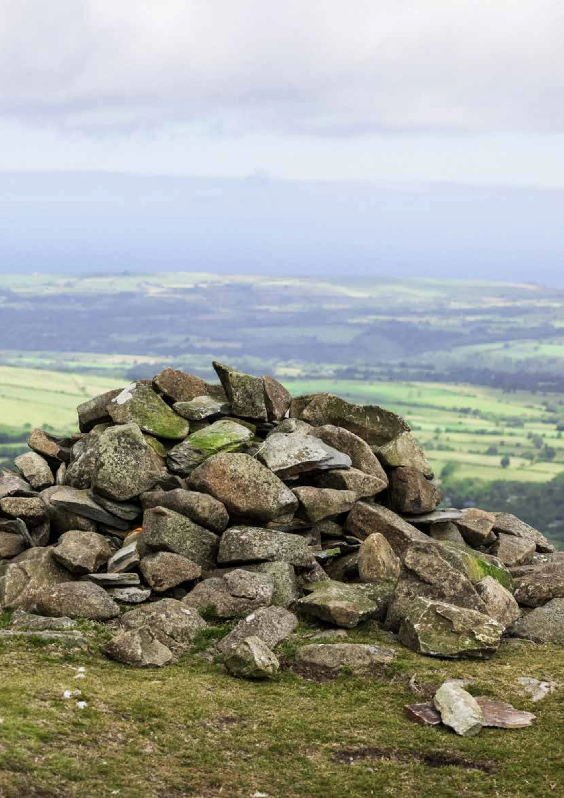
My tribulations so far have given me a greater appreciation for those who trialled the route before me. They often did so from Ireland. I’m walking The Golden Road, a seven-mile, super-high ridgeway running along the spine of the Preseli Hills. The historical significance of this route really is immense. Archaeological evidence suggests it dates back at least 5,000 years to Neolithic times, when people and animals may have walked high grounds to avoid the dense forests and treacherous terrain at lower elevations. The route is believed to have been a significant part of a trade superhighway, facilitating the transport of gold mined from the Wicklow Mountains in Ireland to Wessex. Even more impressively, ancient civilisations utilised The Golden Road to transport the giant bluestones to Stonehenge, 180 miles away. Almost every mile, you glimpse early human activities and migration patterns, passing Bronze Age burial cairns, baffling rock formations, ancient graves, an Iron Age fortress, and a rather important quarry. Hence, the question “How did they do it?” is relevant. I simply cannot fathom how these ancient people with just rudimentary tools and limited understanding could carry out entire communities, businesses, At the start of my walk, I passed Foel Eryr, another mountain-top burial cairn with a large hut and drystone enclosure. These may reflect relict field boundaries or a slipway for a nearby quarry. It’s known as the “Place of the Eagle” because the majestic bird once soared above the mound, but today, only buzzards and red kites can be seen. Such prominent landmarks and traditions hundreds of feet above sea level. I’ve only just walked two miles from Bwlch Gwynt, sporting a lightweight backpack and camera, and yet I need a rest. My first stop is at Foel Feddau, a Bronze Age burial cairn resting silently in the expansive rural landscape. Not much is known about this ancient structure, but it’s part of a much larger tradition of cairn-building in Pembrokeshire.

suggests that high-status individuals were laid to rest along The Golden Road and that these burial rites were important to the Bronze Age tribes who once inhabited this landscape. Broadcaster and writer Wynford Vaughan-Thomas once said of The Golden Road, “Everywhere you feel the presence of the megalithic tomb-builders, of the Iron Age warriors who piled the stones for the great hillforts and of kindly and absent-minded old Celtic saints”. The Golden Road has a special atmosphere, but what I feel most is the presence of the ordinary folk who built these monuments to honour and immortalise their dead. From the summit, I can see Pantmeanog Forest, a place shrouded in legend. According to The Mabinogion, King Arthur and his knights fought a ferocious battle against a boar, the Twrch Trwyth, under the shadows of Foel Cwmcerwyn – the highest point in the Preseli Hills.

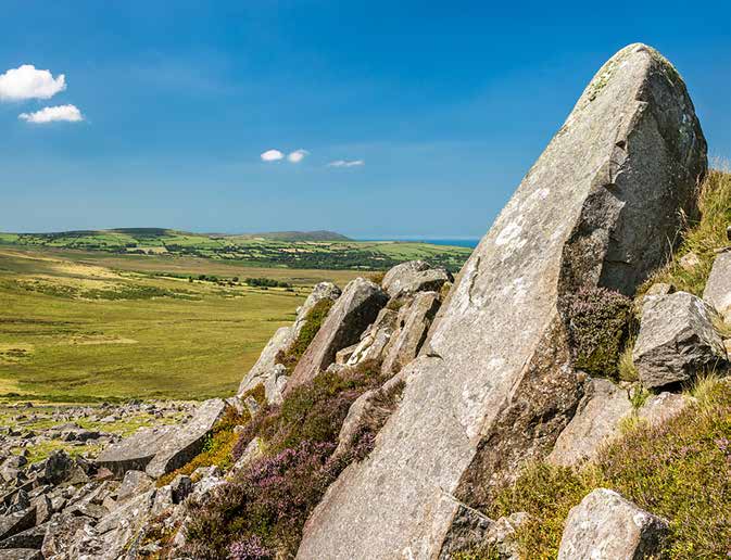
Half a mile downhill, is a line of rocky outcrops at Cerrigmarchogion, and the enormous stones are believed to be the petrified remains of Arthur’s knights who fell in battle. I descend the mountain to reach these rocks, walking along a flat plateau with a meandering path defined by the slender-stemmed Cotton Grass with their white tuft crowns; their feathery clusters sway gracefully in the breeze, transforming the landscape into a dreamy mosaic of snowy dots against the verdant green and muddy brown backdrop. A short detour brings me to the dolerites, which are nothing short of magnificent. You don’t need a vivid Gyda dangosiad ffilm arbennig, gweithgareddau dementia gyfeillgar, sesiynau gwneud a chymryd, cyrsiau gwenyn, ffair grefftau a gweithgareddau'r Pasg, mae rhywbeth i bawb drwy gydol y Gwanwyn!

With a special film screening, dementia friendly activities, make and take craft sessions, a beekeeping course, vintage and makers marker and Easter activities, there’s something for everyone this Spring!

A wider perspective

imagination to picture these stones as fossilised knights; some are tall, others large and stocky, while most are broken in two. The immense size of these "grave" stones leaves me with little doubt that those who claim this was one of the sources for Stonehenge's bluestones are correct. I continue east, climbing to the sharp-edged tor of Carn Bica. As far as the eye can see, rocky outcrops litter the landscape, but it’s the eye-shaped ring of stones below that catches my attention. Bedd Arthur, “the grave of Arthur”, is said to be the King’s final resting place. Whether royalty was buried here or not, tranquillity and stillness wash over this section of the route, suggesting that someone important still haunts this graveyard. Carn Menyn, is another potential quarry for the bluestones of Stonehenge.

After years of erosion, the stones are scattered, but atmosphere around them pulsates with mysteries of bygone days. Another hour brings me to Foel Drygarn, the site of an early Iron Age fortress dating to 350 BCE. It’s the perfect spot to end our walk with its double ramparts, ditches, three Bronze Age burial cairns, and discoveries of Iron Age and Roman pottery, sling stones and glass beads. Historians claim this was once an important centre, with at least 227 huts. The remains represent a long period of occupation and illustrate how Iron Age settlers respected their Bronze Age predecessors, as the cairns went unplundered.

These gigantic memorials are ever-present reminders of our forebearers, showing us their relationship with the landscape despite the changing times and passing centuries. As I leave, I see a family explaining the fort to their youngsters, reassuring me that The Golden Road will remain significant in our collective heritage for a long time to come.

Discover a season of firsts this spring, on a fun-filled wetland adventure with Gozzle the gosling.